Key features
- Interactive map with operator and technology filters
- Time-series analysis to track coverage changes
- Comparison views across operators and areas
- Export to GIS-compatible formats
- Role-based access control for teams
- Secure, UK-hosted infrastructure
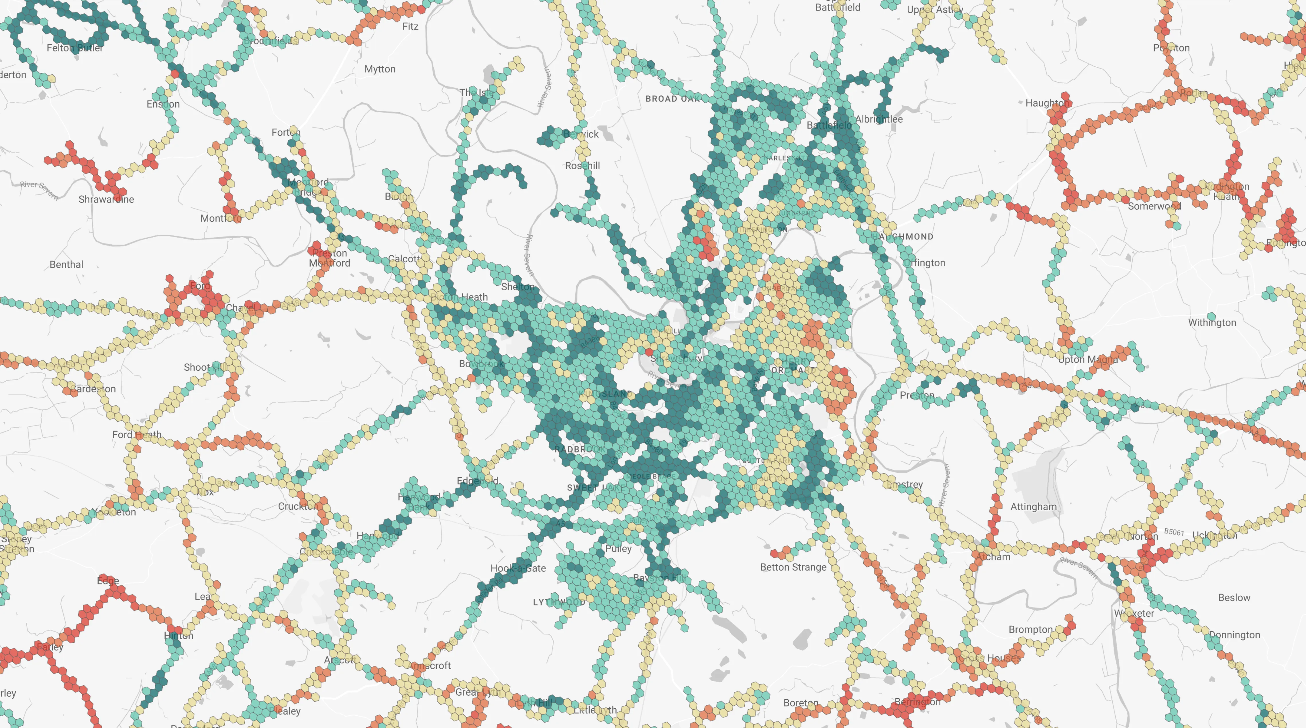
Visualise Mobile Signal at Scale
Streetwave’s Digital Mapping Platform gives local authorities, infrastructure planners, transport authorities and emergency services an intuitive way to explore mobile coverage performance. View real signal data by region, neighbourhood, address, or street—with zero GIS expertise required.
With clear overlays, filter controls, and custom reporting options, it’s built to support better decisions across digital inclusion, public safety, service planning, and investment strategies.
Why Teams Use the Digital Mapping Platform
Built for transparency and insight, Streetwave’s mapping platform empowers public and private teams alike to plan smarter, faster, and with full clarity. Whether you’re visualising coverage gaps, benchmarking networks, or checking planning applications, the platform brings mobile performance into focus.
Support Strategic Planning
Understand where coverage challenges intersect with key services—like high streets, housing zones, or tourist attractions.
Quantify Inclusion and Risk
Identify underserved areas and use visual evidence to support funding bids or service improvements.
Coordinate Across Teams
Share standardised, impartial signal data across departments—from economic developments to social care.
Benchmark Operator Performance
Compare network coverage in key areas to support decisions on infrastructure partnerships or roaming policies.
Product Features
Streetwave data ensures:
- Intuitive Digital Interface - Explore signal strength, speeds, and network quality through easy-to-use filters and visual layers.
- Multi-Network Comparison - Compare performance across mobile operators—side by side, down to the street level.
- Map & Export Tools - Overlay coverage with key infrastructure, export maps for reports, or integrate with GIS workflows.
- Always Current - Data updates with every hardware pass-through, meaning insights reflect live ground conditions.
Ready to get started?
Schedule a demo or get in touch to discuss how Streetwave can help your organisation.