Visualise and Understand Mobile Network Coverage.
Streetwave Maps Mobile Coverage Performance for Every Road Nationwide
Who we serve
Built for the Telecoms Industry, People and Governments
Our regulator trusted methodology ensures that we are the dependable source for mobile coverage intelligence in the UK.
Trusted and backed by


Solutions by Sector
Streetwave works across sectors to turn mobile coverage maps into actionable insight. From councils and police to MNOs and rail operators, our real-world data helps public and private partners plan with confidence, prove impact, and close coverage gaps.
Mobile Network Operators
Independent benchmarking and network validation data to support site planning and regulatory compliance.
Tower Companies
Identify site opportunities and strengthen planning applications with verified coverage gap evidence.

Rail & Transport
Map passenger experience across lines and tunnels to identify gaps and support connectivity improvements.

Local Government
Pinpoint connectivity blackspots and give residents accurate coverage information through public-facing tools.

Regulators
Validate coverage claims against independently measured data to inform policy and protect consumers.

Utilities
Verify connectivity at infrastructure locations to support smart meter rollout and remote monitoring.

MVNOs
Benchmark your host network's real-world performance and optimise coverage-based targeting.
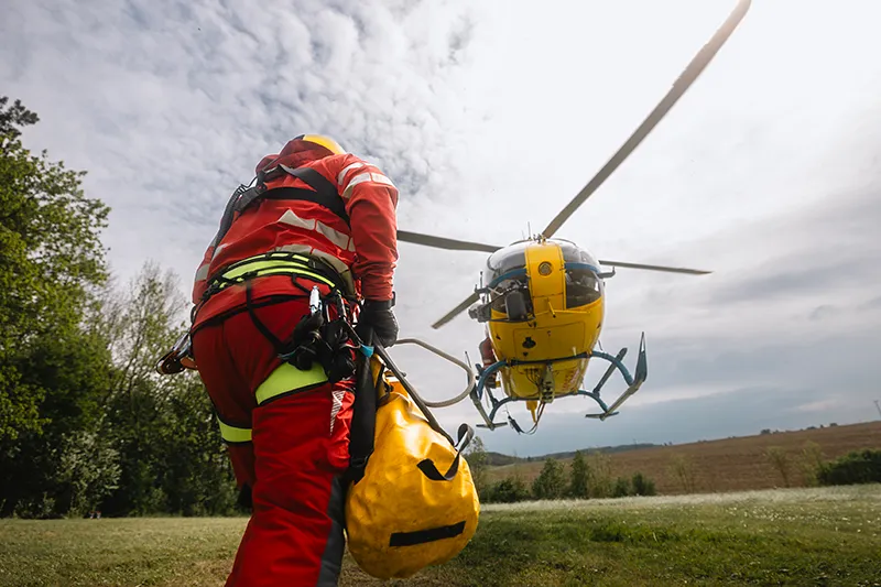
Emergency Services
Map mission-critical corridors and verify fleet communications are reliable when it matters most.

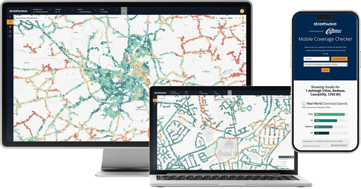
Consumers
Compare real coverage at your address and choose the network that will actually work for you.
Products
From on-demand data collection to developer APIs: tools that bring independent coverage data to life.

Data Collection On-Demand
Bespoke signal data collection across roads, rail and pedestrian environments, anywhere in the UK.

Portable Mapping Units
Compact, battery-powered sensors for rapid, flexible coverage surveys in any environment.
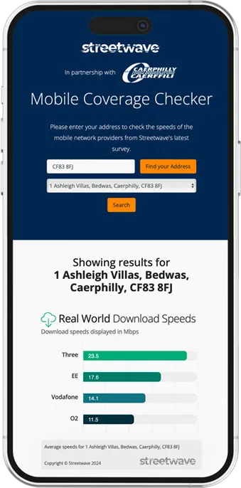
Coverage Maps & Checker
Public-facing and embedded coverage tools powered by verified real-world measurement data.
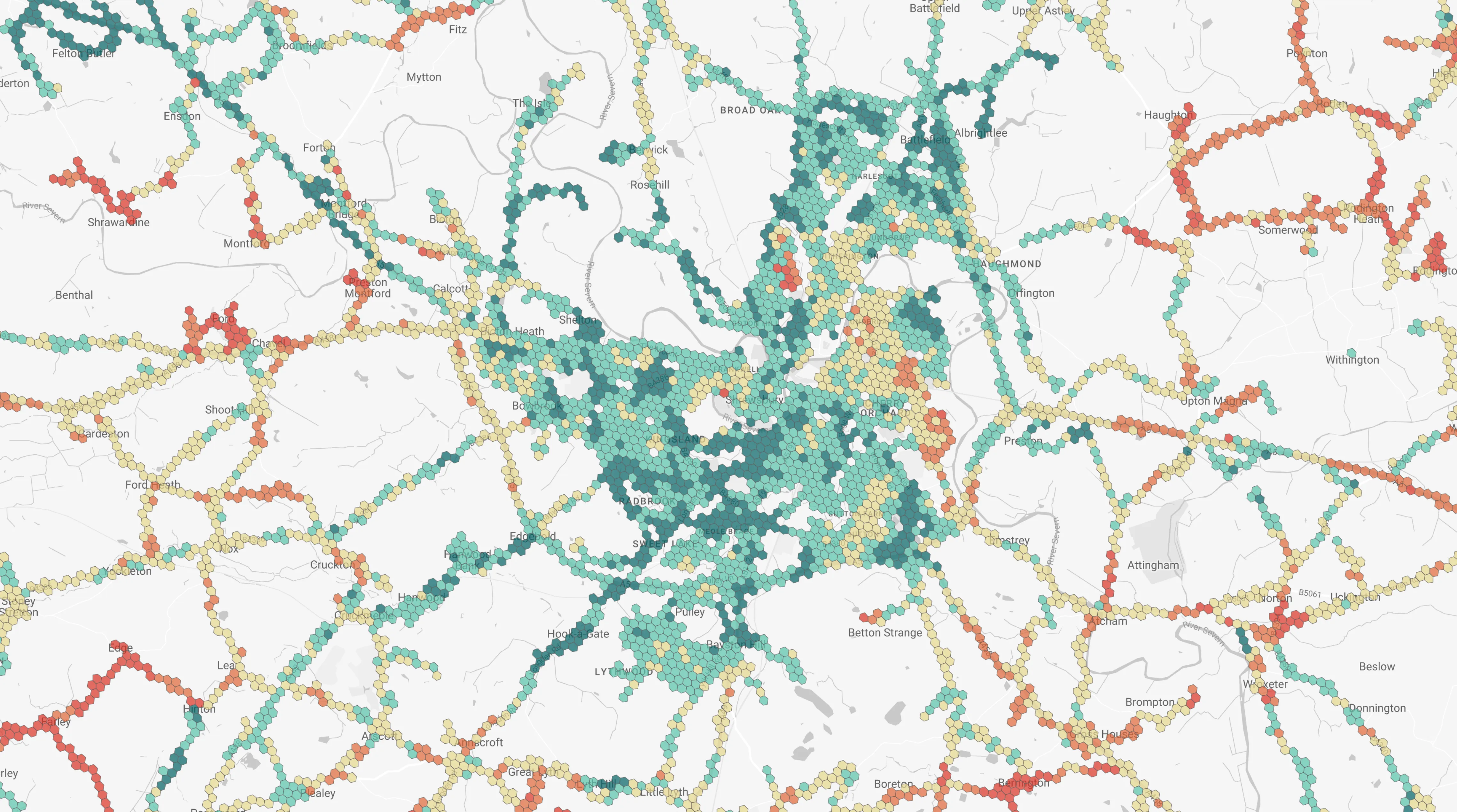
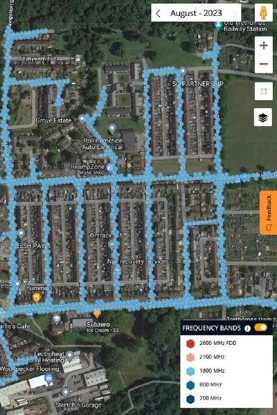
Digital Mapping Platform
Interactive coverage maps with operator filtering, time-series analysis and GIS export.
Coverage Data APIs
Integrate real-world signal data into your applications via address, postcode or polygon query.
As featured in
Latest News
Coverage initiatives, council partnerships, and industry insights.
Three Scottish Councils Begin Mobile Coverage Mapping
Three Scottish local authorities are carrying out checks on the quality of network reception and helping to identify mobile blackspots across their areas.
Brent Council Launches Public-Facing Mobile Coverage Map
Brent has become the latest London borough to launch a public-facing mobile coverage map, powered by Streetwave's real-world measurement data.
Streetwave to Map 4G and 5G Coverage Across Liverpool City Region
A major coverage mapping initiative covering the Liverpool City Region will provide detailed 4G and 5G data to support connectivity planning across the area.
Frequently Asked Questions
Everything you need to know about how Streetwave works.
Operator coverage maps are generated from network models — computer simulations of expected signal propagation. Streetwave collects actual signal measurements using calibrated hardware physically present in the location being measured. This means we can detect coverage gaps that models miss, and confirm coverage that models might overstate.
We deploy compact measurement sensors on vehicles operating in target geographies — typically council fleet vehicles like refuse lorries, highways vans, and transport services. Each sensor collects signal data from all four major UK operators simultaneously, GPS-synchronised at 1-second intervals, covering roads, rail corridors, and pedestrian environments.
Yes. By fitting sensors to vehicles that already operate in these areas — including bin lorries that service residential streets and rural lanes — we can achieve comprehensive coverage of areas that would be impractical or uneconomical to survey by conventional means.
We collect 30+ KPIs per measurement point, including signal strength (RSRP, RSRQ, SINR), data throughput (uplink and downlink), latency, packet loss, voice quality indicators, and network technology (2G/3G/4G/5G). A full data dictionary is provided with every dataset.
This depends on the geography and the arrangement in place. For councils with active collection programmes, data is refreshed on a regular cycle — typically quarterly or annually. On-demand data collection projects are delivered on the timescale agreed at commission.
We deliver data in CSV, JSON, and GeoPackage (GPKG) formats. Our digital platform provides browser-based access without requiring any data export. API customers receive JSON or GeoJSON responses.
Ready to see real coverage?
Schedule a demo and we'll show you exactly what Streetwave data looks like for your geography.